Topographic Maps & Trails
By LW Brands, LLC · Navigation · $4.99 Updated 2 months ago
Screenshots

About
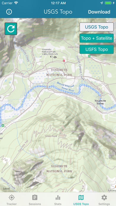
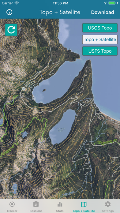
DOWNLOAD ALL MAPS FOR OFFLINE USE MAIN FEATURES INCLUDE: - USGS Topographic Maps - Satellite + Topo Maps - Hiking Tracker USGS TOPO MAP USGS Topo is a tile cache base map service that combines the most current data in The National Map (TNM), and other public-domain data, into a multi-scale topographic reference map. TOPO + SATELLITE USGS Imagery Topo is a tile cache base map of orthoimagery in The National Map and US Topo vector data. Orthoimagery data are typically high resolution images that combine the visual attributes of an aerial photograph with the spatial accuracy and reliability...
What's New (v1.7)
Quick Facts
📱 Category: Navigation
👨💻 Developer: LW Brands, LLC
💰 Price: $4.99
⭐ Rating: 4.6/5 from 2,800 users
🏷️ Genres: ["Navigation"]
🔞 Age Rating: 12+
📦 Size: 23 MB
🔢 Version: 1.7
📲 Requires: iOS 15.0+
📅 On App Store: 7 years
🌍 Languages: 1
Get the full Navigation market analysis — complaints, features, pricing, competitors.
View Navigation Report — $9.99