Terrain Radar Altimeter
By Nestele Engineering · Altimeter · Free ⚠ Last updated 2 years ago
Screenshots

About
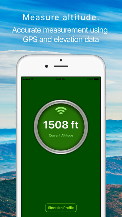
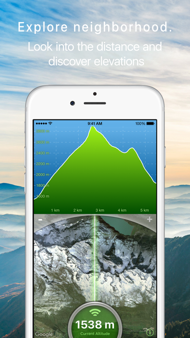
Measure the elevation of each location within a radius of 500 meter. With Terrain Radar Altimeter you can discover the height of hills in front of you or take a look at further away mountains. The unique combination of device sensors and internet-based geo informations makes Terrain Radar to the best altimeter app in the store. FEATURES: • High accuracy digital elevation model • Range up to 500 meter (1600 ft) • Calculation of altitudes in real time • Precise elevation chart • Display in meter or feet The altitudes are calculated through online services, based on your GPS position and...
What's New (v2.8.0)
Quick Facts
📱 Category: Altimeter
👨💻 Developer: Nestele Engineering
💰 Price: Free to download
⭐ Rating: 4.7/5 from 733 users
🏷️ Genres: Navigation, Utilities
🔞 Age Rating: 4+
📦 Size: 21 MB
🔢 Version: 2.8.0
📲 Requires: iOS 13.0+
📅 On App Store: 13 years
🌍 Languages: 2