i-Boating: Marine Charts & Gps
By Bist LLC · Kayaking Guide · Free Updated 1 months ago
Screenshots

About
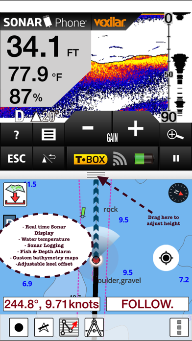
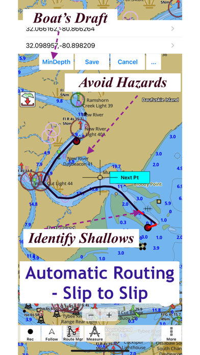
This App offers access to Marine Charts for USA,Canada,UK/Ireland,Germany,Netherlands/Holland & Europe Rivers (Danube,Drava,Rhein etc). Coverage includes NOAA marine vector charts,freshwater lake maps,USACE inland river maps (HD/1ft/3ft bathymetry included where available),charts derived from UKHO & CHS data. First marine GPS app to have route assistance with Voice Prompts for marine navigation. You can create new boating routes or import existing GPX/KML routes. It supports Nautical Charts course up orientation. Includes Tide & Currents prediction. ►FEATURES √ Beautiful & detailed Hardware/...
What's New (v168.0.0)
Quick Facts
📱 Category: Kayaking Guide
👨💻 Developer: Bist LLC
💰 Price: Free to download
⭐ Rating: 4.5/5 from 14,099 users
🏷️ Genres: Navigation, Travel
🔞 Age Rating: 4+
📦 Size: 49 MB
🔢 Version: 168.0.0
📲 Requires: iOS 12.0+
📅 On App Store: 10 years
🌍 Languages: 8